Parks & Trails
Sub Neighbourhood Park
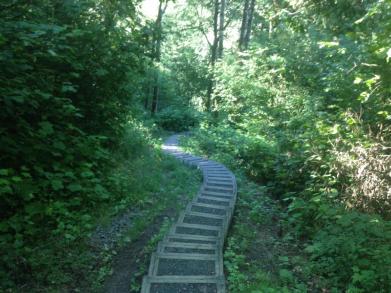
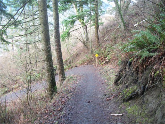
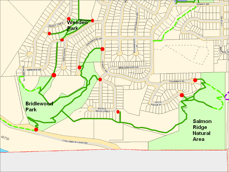
Bridlewood Park is a 7 hectare wooded area located on the south side of Promontory. The park is linked via the Salmon Ridge Trail to the 10.6 hectare Salmon Ridge Natural Area.
While there are no constructed facilities, the park contains over 2 km of hiking trails with trailheads and on-street parking at Chilliwack Lake Road, Teskey Road, Sherwood Drive, Weeden Drive, Bridlewood Crescent, Cecil Ridge Place and Tournier Place. These parking areas are indicated on the map below by red dots.
The trails are linked to the north with the trails in Weeden Park.
| Documents | |
| Preview | Title |
 |
Map |
Adopt a Park/ Adopt a Trail
The City of Chilliwack has partnered with a number of local organizations and non-profit groups to develop an Adopt-a-Park and Adopt-a-Trail program. Groups volunteer their time to cleanup parks and trails in Chilliwack, to keep the community looking its best!
Greenspace / Trail Network Plans
Created as a supporting document to Chilliwack's Official Community Plan (OCP) the Greenspace Plan and supplementary Trail Network Plan sets out the City's goals and visions for developing new parks and trails over the coming decades.
Parks
The City of Chilliwack has over 100 parks and natural areas which together make up over 400 hectares of green space.
Responsible Drinking in City Parks
Information about the areas in Vedder Park where responsible alcohol consumption will be permitted May 15 - October 31.
Trails
A listing of cycling / hiking trails in Chilliwack and vicinity.
Online Field Status
With the changing weather these days, it’s easy to check the status of Sports Fields online.